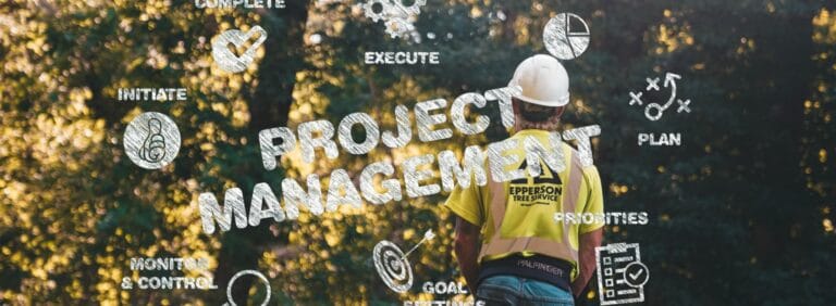

Across oil and gas, environmental services, and infrastructure, field operations teams in 2026 are handling more sites, more stakeholders, and stricter compliance expectations with the same or smaller headcount. Most field teams that still rely on spreadsheets, email chains, and disconnected mobile apps find themselves struggling with duplicate data entry, missed updates, and no consolidated view of what is happening across their portfolio.
This guide covers four key field operations trends Matidor is seeing in 2026 and how a GIS native, offline capable platform supports multi-site teams that need better visibility, documentation, and budget control.
Why field operations look different in 2026
Environmental monitoring requirements are more prescriptive, reporting deadlines are tighter, and data quality expectations from regulators, clients, and investors have increased. At the same time, field teams are expected to cover more locations, collect richer data, and collaborate seamlessly with office staff who may be in different regions or even time zones.
Legacy tools such as spreadsheet trackers, email chains, and disconnected mobile apps make it hard to keep everyone aligned. Teams that rely on these approaches often struggle with duplicate data entry, missed updates, and a lack of portfolio level visibility across active sites.
Trend 1: Multi-site portfolios are the new normal
Most field operations teams are no longer dealing with a handful of projects. It is common to have dozens of active assessments, remediation jobs, inspections, or abandonment programs running in parallel across a wide geography. This creates three practical problems:
- Work gets scheduled and rescheduled constantly as priorities and access conditions change.
- It becomes difficult to see bottlenecks and conflicts across contractors and crews.
- Leadership lacks a consolidated view of which regions or programs are on track.
Matidor was built specifically for multi-site operations. The platform's project management capabilities let teams see all active field projects on one portfolio dashboard with status, timelines, and budgets summarized for easy review. That makes it easier to answer questions like "Where are we over committed?" and "Which regions are trending behind on compliance inspections?" without mining multiple reports.
For readers who want to see how this applies across industries, Matidor's solutions overview covers common multi-site patterns in oil and gas, environmental services, and infrastructure.
Trend 2: GIS is moving from nice to have to required
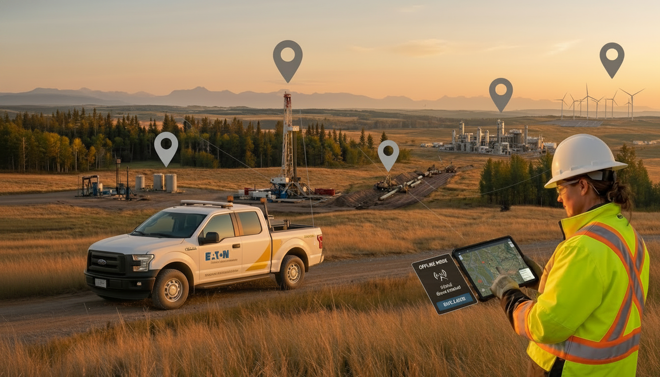
Field work is inherently spatial. Whether you are managing orphan well abandonment, pipeline inspections, environmental site assessments, or vegetation management, location context matters for risk, access, and compliance. Teams that rely on spreadsheets and static maps often struggle to see patterns such as clusters of high risk sites or overlapping projects in the same region.
A GIS native operations platform brings location intelligence into everyday workflows. Matidor combines project management with interactive mapping so that every project, site, document, and cost record is tied to a point or polygon on the map. Users can filter by project type, status, risk rating, or client, then zoom into specific areas to plan work and monitor progress.
In practice, this helps teams:
- Spot site clusters that can be visited in one trip.
- See how project footprints intersect with sensitive areas or regulatory zones.
- Give executives a visual overview of current activity across the portfolio.
Learn more about this mapping first approach on Matidor's Location Intelligence product page and GIS integration hub.
For a practical overview of how GIS changes the day-to-day, see How Mobile GIS Improves Field Service.
Trend 3: Offline first mobile is table stakes
Field crews work where the projects are, which often means remote locations with unreliable connectivity. Many organizations have discovered the limits of always online apps when data failed to sync from the field, leaving gaps in inspection records, photographs, or forms. Regulators and clients do not accept connectivity issues as a reason for missing documentation.
Offline first mobile workflows have become a standard requirement. With Matidor, field users can download project data before leaving the office, capture forms, photos, and notes without a network connection, and let everything sync back to the central platform once they are back in range. This reduces the need for paper backups and end of day rekeying, while improving data quality and timeliness.
See Matidor's Field Operations product page for a full overview of offline mobile capabilities, and the blog on offline data sync for field operations for a deeper look at how syncing works in practice.
Trend 4: Real time budget visibility for field projects
Budget pressure is not new, but the tolerance for surprises is lower in 2026. Finance and operations leaders want real time visibility into how field projects are performing against plan so they can reallocate spend and avoid overruns before invoices pile up. Many teams still track estimates and actuals across multiple spreadsheets, which makes it difficult to see portfolio level trends.
Matidor's budget and cost control capabilities provide real time budget tracking at both project and portfolio levels. Teams can set budgets, capture actual costs as work proceeds, and see variances on dashboards that aggregate data across all sites. Alerts can be configured when spending approaches thresholds, giving managers time to adjust scope, sequencing, or resource allocation.
For practical guidance, Matidor's article on how to track field project budgets in real time walks through a typical workflow.
How to evaluate your field operations stack in 2026
Given these trends, it is a good time to step back and assess whether your current tools still fit your portfolio. When evaluating platforms, consider:
- Can the system show every active project on a map and a portfolio dashboard in seconds?
- Do field crews have a consistent, offline capable way to capture forms, photos, and notes?
- Are compliance documentation and project files tied to specific locations and tasks rather than scattered across shared drives?
- Can operations and finance see up to date budgets and variances without consolidating spreadsheets each month?
Matidor's GIS native platform is designed to replace a patchwork of spreadsheets, static maps, and siloed mobile apps with one shared view of projects, sites, and budgets. Customer stories such as Rife Resources and Ridgeline show how standardizing on a single platform gave teams capacity to manage many more projects with the same staff.
Frequently asked questions
What is GIS-native field operations software?
GIS-native software means that every project, site, and cost record is mapped geographically by default, not added as an afterthought on top of a table based system. Matidor is built map first so that location context is part of every workflow, from planning and scheduling to documentation and reporting.
Why does offline mobile matter for field operations compliance?
In remote locations with no connectivity, crews need to capture forms, photos, and logs without relying on a network. Offline first apps store data locally and sync automatically when a connection is restored, ensuring no compliance records are lost.
How do portfolio dashboards help with multi-site field operations?
Portfolio dashboards give managers a single view of project status, budget health, and schedule across all active sites. Instead of chasing weekly update emails, teams can see where projects are on track and where intervention is needed in seconds.
What is the difference between field operations software and project management software?
General project management tools are built for office based workflows. Field operations software is designed for distributed, location based work with offline mobile, GPS data capture, map based planning, and compliance documentation built in from the start.
Next steps for operations and environmental leaders
If you are responsible for field operations, environmental compliance, or project portfolio management, 2026 is a good time to benchmark your current workflows against these trends. Start by mapping your active projects, tools, and data flows, then identify where you lack visibility, where information gets rekeyed, and where offline work creates gaps.
To explore what a GIS native, offline capable field operations platform could look like for your organization:
- Review Matidor's solutions overview for oil and gas, environmental services, and other field intensive industries.
- Walk through the field operations and project management product pages with your team.
- Use the Matidor evaluation page to see if the platform fits your portfolio and compliance needs.
- Start a free 14 day trial or request a demo to see real examples of multi-site portfolios, offline mobile workflows, and budget dashboards in action.


.jpg)
.jpg)

.jpg)
.jpg)
.jpg)


.jpg)